Hurricane Rapid Intensification: Decades of Data Defy Expectations
Atmospheric GHG concentration plays minor role in hurricane rapid intensification.
Hurricane Rapid Identification (RI)…
Hurricane rapid intensification is a phenomenon where a tropical cyclone significantly increases its intensity in a short period. Typically, rapid intensification is defined as an increase in maximum sustained winds of at least 35 mph (about 30 knots) within a 24-hour period. This abrupt change can be particularly challenging for forecasters and can lead to quick shifts in storm preparedness for areas in the path of the storm. Rapid intensification can transform a relatively mild storm into a major hurricane in less than a day.
While hurricanes and their behaviors have been observed for centuries, our scientific understanding of rapid intensification has been refined more in the last few decades with the advent of ever more sensitive satellite monitoring. This allowed meteorologists to observe storms in real-time and track their evolution more accurately. As computational power increased and meteorological models improved, the research community began to identify and understand the environmental conditions and internal processes that contribute to rapid intensification.
The phenomenon of rapid intensification has likely been occurring for as long as hurricanes have existed. Prior to the satellite era, hurricane intensity was gauged through ship reports, island-based observations, and later, aircraft reconnaissance. While these methods provided valuable data, they had their limitations and did not offer the continuous monitoring capability that satellites do.
It was only with the widespread use of satellites, especially towards the end of the 20th century, that meteorologists were able to observe tropical cyclones in real-time over the open ocean. This made it possible to detect rapid intensification events that might have been missed or less accurately quantified in earlier years.
Rapidly intensifying Hurricane Camille in 1969…
One early well-documented case of rapid intensification was Hurricane Camille in 1969. Camille formed as a tropical depression on August 14, 1969, in the Caribbean.
As it moved into the Gulf of Mexico, it rapidly intensified, reaching Category 5 status before making landfall on the Mississippi Gulf Coast on August 17. Camille is one of the strongest hurricanes on record to make landfall in the U.S., with sustained winds estimated at 175 mph and a minimum central pressure of 900 mb.
Camille resulted in significant loss of life and property. Its rapid intensification in the Gulf of Mexico caught many off-guard, as hurricane forecasting and understanding of rapid intensification were not as advanced as they are today.
That being said, Camille is just one example from the satellite era. Earlier storms likely underwent rapid intensification, but without the detailed observations that satellites or aircraft reconnaissance can provide, many went undetected.
Rapidly intensifying Hurricane Otis…
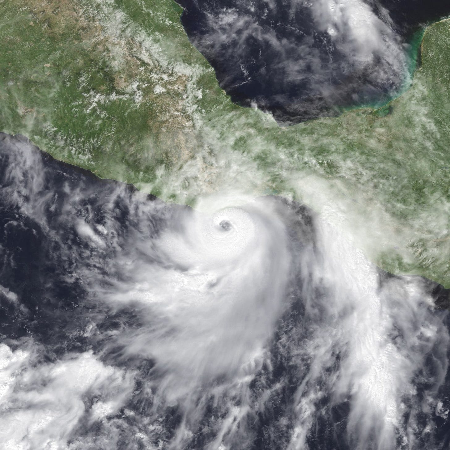
On October 25, 2023 at 12:25 A.M. local time, Hurricane Otis made a devastating landfall in Central Mexico with wind speeds reaching approximately 165 miles per hour, as reported by the National Hurricane Center (NHC). This marked the region's first encounter with a Category 5 storm.
Early predictions on Tuesday indicated that the local sea surface temperatures were elevated, around 86 degrees Fahrenheit (30 degrees Celsius), and it was anticipated that the storm would escalate into a hurricane as it approached Acapulco. However, by the evening, NHC's analysts were growing anxious about Otis's trajectory, pointing out its unforeseen and dramatic strengthening throughout the day.
In approximately 12 hours, Otis transformed from a tropical storm into a formidable Category 5 hurricane. When it made landfall, it was recognized as the most powerful storm on record to strike this region and the Pacific coast of Mexico.
Although it appears that Hurricane Otis underwent unprecedented rapid intensification, I wanted to remind people that large hurricanes in this part of the world in October, particularly during the onset of an El Nino, are not uncommon.
Hurricane Pauline was a powerful and deadly tropical cyclone that affected portions of Central America and Mexico in October 1997, during the 1997-98 El Nino event. It was one of the most devastating hurricanes to hit the Pacific coast of Mexico in recent history.
Pauline developed from a tropical wave into a tropical storm on October 5, 1997. It quickly strengthened into a hurricane the next day. The storm primarily moved northwestward, paralleling the southern coast of Mexico. Pauline reached its peak intensity on October 7, with sustained winds of about 135 mph (215 km/h), classifying it as a Category 4 hurricane on the Saffir-Simpson scale.
The hurricane made landfall near Puerto Angel, Oaxaca, on October 8, with winds of about 115 mph (185 km/h). The system moved along the Mexican coast, bringing heavy rains, strong winds, and high surf. The cities of Acapulco and other areas in the states of Oaxaca and Guerrero were hardest hit. Entire communities were swept away. The flooding destroyed homes, bridges, roads, and other infrastructure. Agriculture was heavily affected, with vast areas of crops being destroyed.
The exact death toll varies between sources, but it's widely accepted that the storm caused the deaths of at least 250 people, with some estimates placing the figure at over 400. Thousands of people were left homeless. The economic cost of the storm's damage was estimated at hundreds of millions of U.S. dollars.
Hurricanes are devastating and my heart goes out to the people affected by Hurricane Otis. But the reality is that these storms are a fact of life in certain areas of the planet, and our emissions of GHGs have little effect on their intensity and frequency.
Environmental conditions leading to rapid intensification…


